An oil and gas operator experienced changes in the geometry at the end of a pipeline in a deepwater environment.
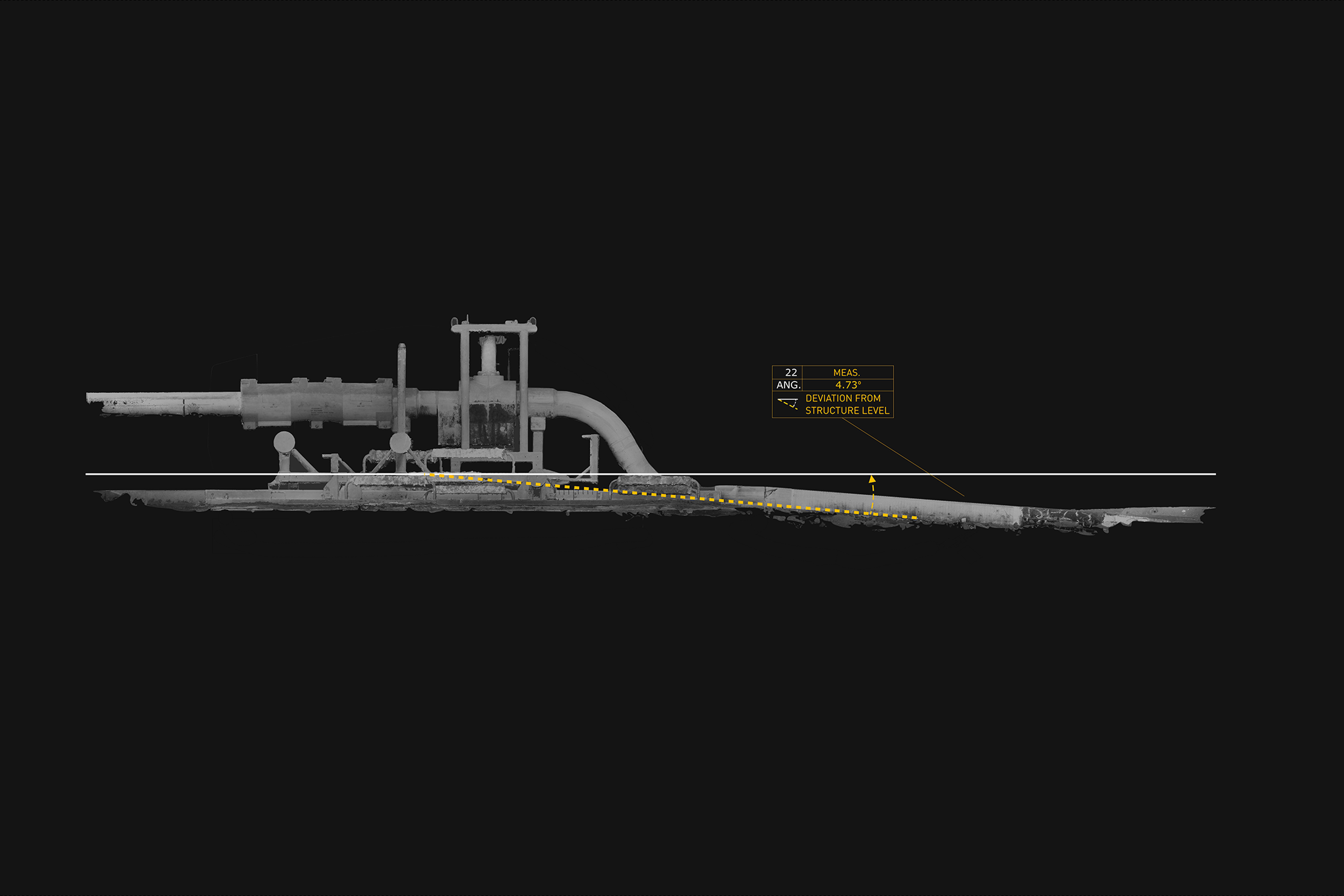
The client needed to understand the current ‘as-is’ status, and relative angle of the pipeline as it entered the subsea structure, while also investigating any further damage.
Having previous experience of working with Viewport3, both the operator and the marine contractor tasked us with actioning a plan which would answer their questions.
With a tight deadline from scan to delivery, our biggest challenge on this project was the time-frame.
We worked closely with the marine in-country contractor to ensure that the scan was performed correctly, and that it would provide the answers the operator required.
The only equipment required to access the deepwater site was a single workclass ROV, and the capture sessions were completed within 2 dives.
A two-tiered verification system was employed by Viewport3 in order to maintain control of both the data captured, and accuracy statement being achieved.
The vessel was then able to leave the field with the knowledge that the quality of the data met the required standard.
Viewport3’s knowledge of the subsea hardware was invaluable in aiding the customer to fine-tune their ROV dive plans to ensure that the data captured would reach the required standard.
The onboard ROV team custom made equipment that allowed the camera system to scan particular specified angles with minimal supervision.
Close collaboration with the customer ensured that the team were prepared for the task in hand, and conversant with the aims of the 3D scanning operation.
The scanning results enabled the marine contractor and operator to fully understand the angle of the pipeline and the ‘as-is’ geometry. As a result, any doubts regarding the stability and geometry of the remaining subsea structure were removed.
This project proved extremely valuable for Viewport3. Our work validated the benefits of using accurate 3D scan data as a basis for engineering design which would subsequently aid the efficiency of offshore operations.
Equally, the 3D data supplied to the client enabled them to make a complete revision to the future intervention operations at the structure, without adding contingency plans.
The campaign – from scan to delivery of data – was undertaken inside the client’s aggressive schedule, something that had been specified as a priority from the outset.
