North Sea based operator, working at FPSO located in the Central North Sea.
Q2 of 2018, a returning customer approached Viewport3 with a need to perform underwater 3D scanning of several mooring line locations.
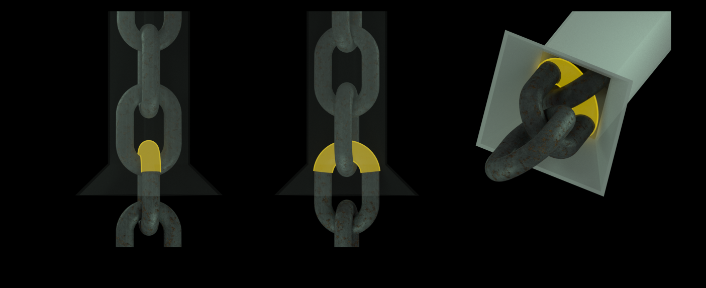
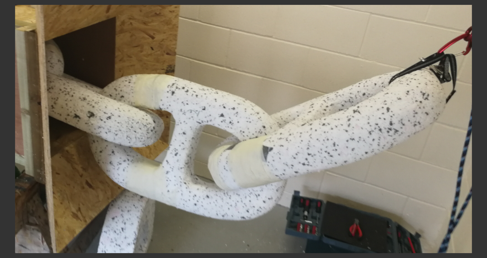
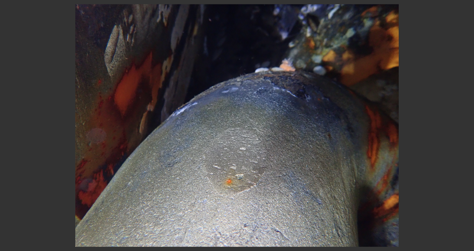
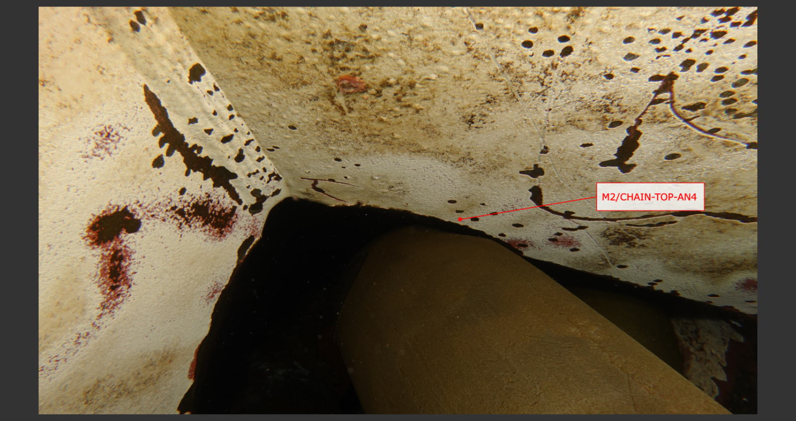
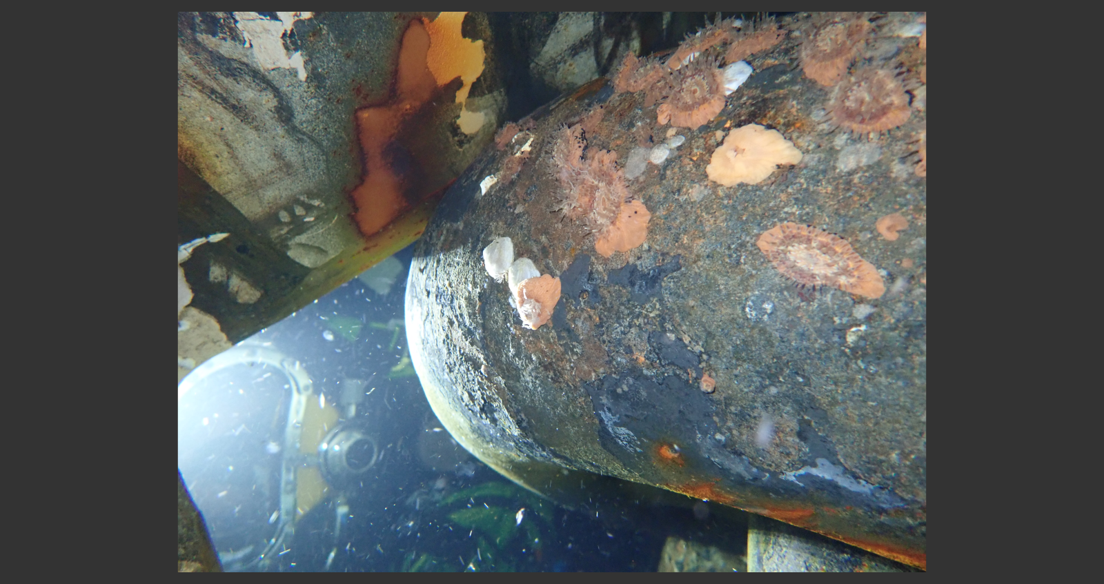
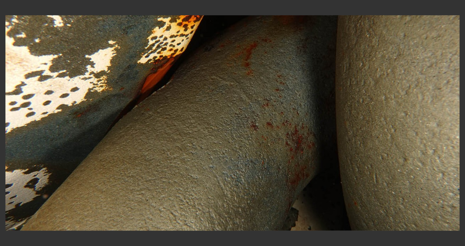
In order to satisfy Class Inspection requirements, additional inspections of certain mooring links were required following discovery of material loss on the shoulders of several mooring links following a period of ‘fretting’ against the obtuse inside corner of the hawse pipe. The client’s need for specialist help soon became apparent – the link shoulders in question were entirely hidden by the hawse pipe, and no options to ‘pay-out’ any mooring line (to bring the target links into open-water) were available.
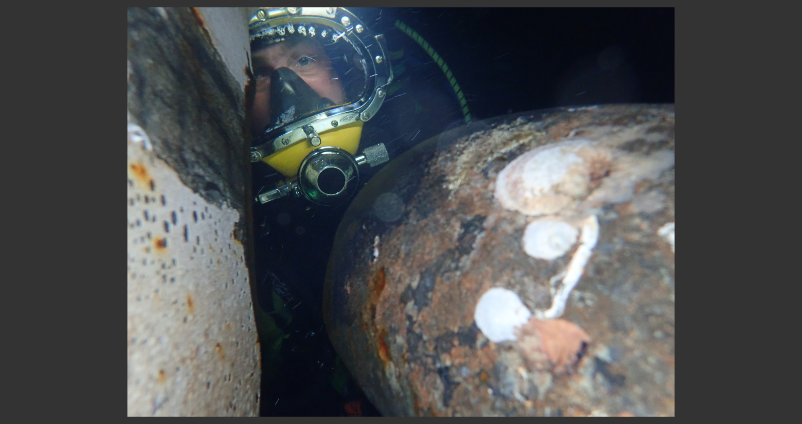
Due to its capability to achieve the smallest possible hardware form factor, image-based 3D scanning by photogrammetry was chosen as the best option to complete the inspection and deliver demonstrably accurate measurements of the affected areas to the waiting Certifying Authority. Air divers were to perform the work at a depth of ~14m.
The customer further advised that several companies had tried and subsequently failed to retrieve such data in the past. As such it was clear to the Viewport3 team that a novel approach to a novel problem was required.
Viewport3 were selected to carry out the specification of the capture system, diver training, offshore image management as well as the 3D reconstruction, analysis and engineering reports.
The industry has often faced challenges in trying to inspect mooring line links which reside within a hawse-pipe. As well as the space restriction, there are limits in terms of how far into a hawse-pipe a diver is permitted to reach. It was necessary to design a capture system which applied the correct level of lighting and photographic integrity, whilst maintain full compliance with the limitations of the dive personnel.
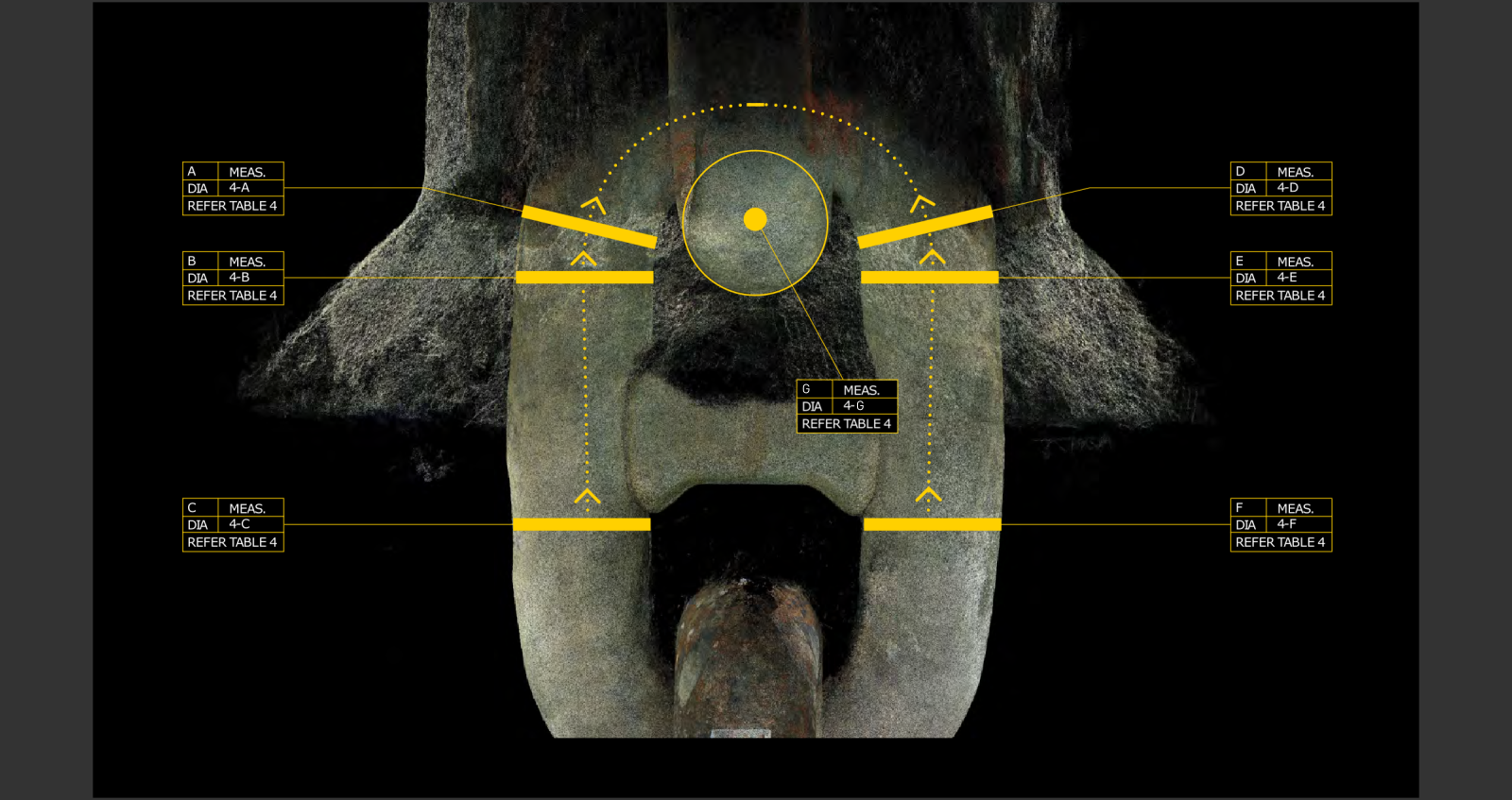
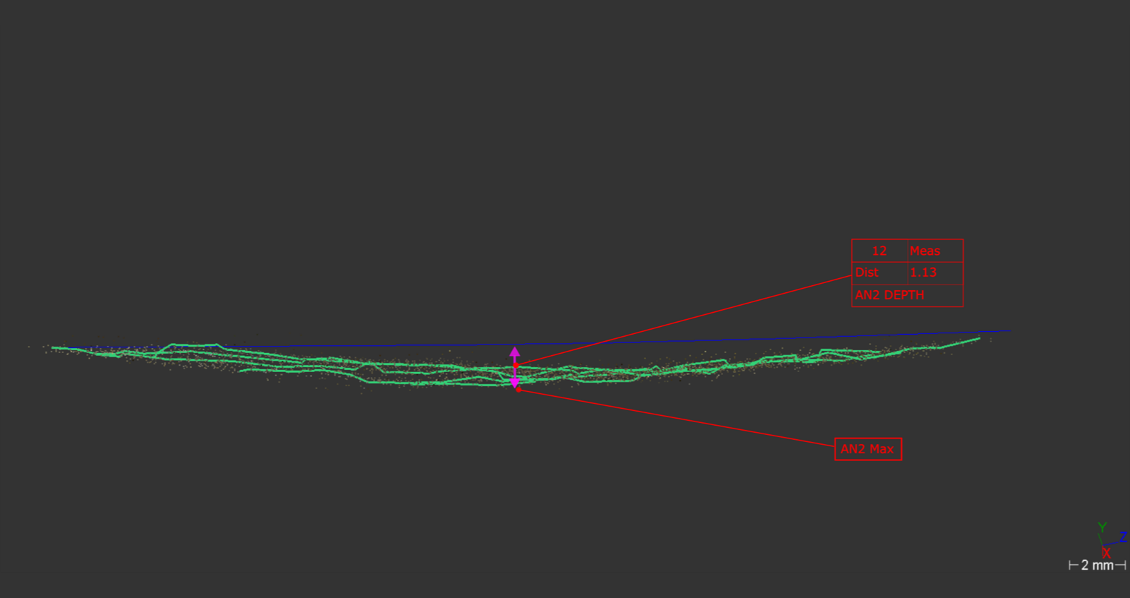
The specification for the project was full sub-millimetric 3D reconstruction of the links identified.
In hardware terms, two sets of capture equipment were designed and provided for the project;
Firstly, a modern compact digital camera with additional external lighting was configured to suit shallow-water diver operation. This arrangement was used to efficiently and accurately capture areas of the mooring link which were not obscured by the hawse-pipe.
Secondly, an arrangement aimed at overcoming the space restrictions within the hawse was designed. It was of course also necessary to provide additional lighting in order to allow use of a small aperture, fast shutter and low sensitivity camera settings to ensure that the end result 3D data fitted the original brief, despite the divers not being able to fully see the target anomalies.
In an example of great collaboration with the subsea team, each diver concerned with the operation was made available on the vessel to undergo photography instruction and a project specific training sessions with Viewport3. These sessions proved highly valuable and produced 3D data-sets which satisfied the original brief.
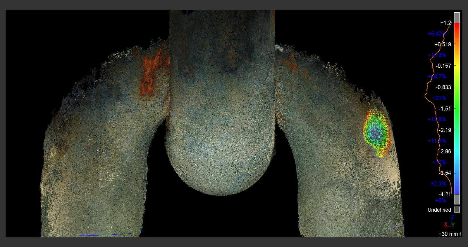
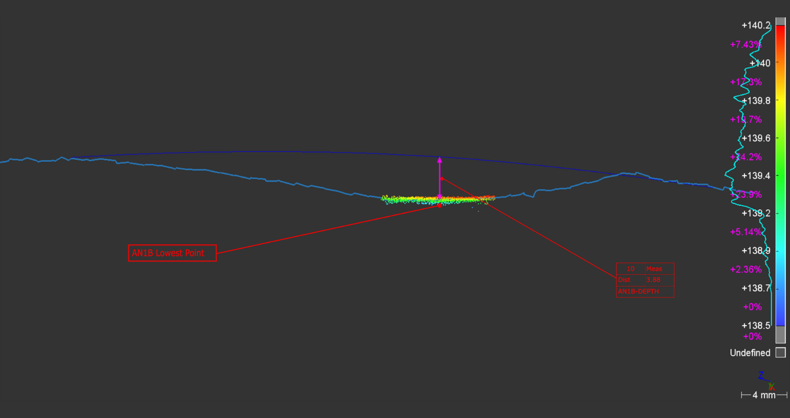
Following completion of the 3D reconstruction activities, the next task was of course to analyse and report on the data. As may be expected, such a niche project demanded that Viewport3 continue their innovative approach into the post-processing phase, in the form of developing a method of digitally re-applying the original surface of the mooring link by inference. This allowed us to answer the original questions ‘how deep are the anomalies / can you quantify the material loss’.
Alongside this data, bar-stock readings from the anomalous areas and readings from more traditional areas were taken, for comparison purposes.
The final data was present to the Certifying Authority and fully satisfied their heightened level of interest in the asset’s mooring system.
