Subsea Photogrammetry: Engineering-Grade Dimensional Assurance
Subsea 3D imaging and photogrammetry are now widely referenced across offshore energy, renewables, defence, nuclear and marine infrastructure. Yet despite growing adoption, many engineers remain sceptical.
That scepticism is justified.
The problem is not photogrammetry itself. The problem is how loosely the term is applied—and how often “3D scanning” is confused with dimensional certainty.
This page explains what subsea photogrammetry really is, why outcomes vary so dramatically, and what defines engineering-grade 3D imaging.
Technical definitions
1. Engineering Grade Dimensional Assurance
The controlled acquisition, processing, verification and reporting of 3D dimensional data to a defined and demonstrable level of accuracy and uncertainty, suitable to support engineering evaluation, integrity assessment and classification-related decision making. Learn more about our certified dimensional analysis methodology.
2. Still image
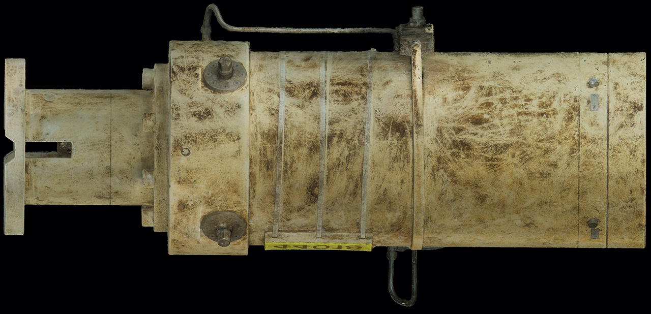
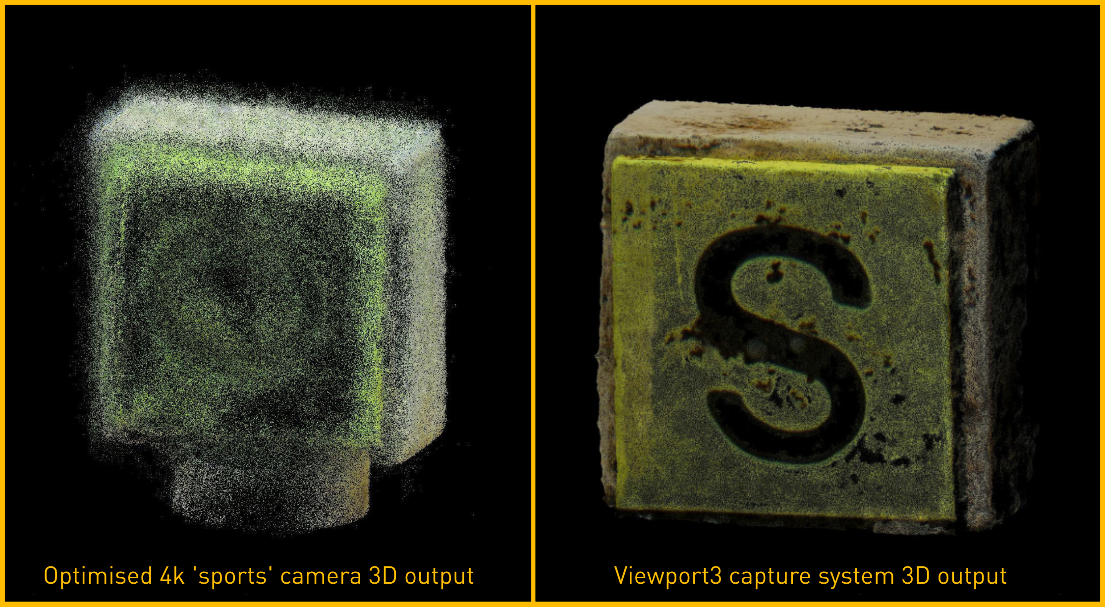
A still image is a high-resolution, static photograph used as the primary data source to create 3D models of underwater objects or environments. Still images are captured ‘all-at-once’ using a global shutter, rather than compromised ‘rolling shutter’ method used by video cameras.
What is subsea photogrammetry?
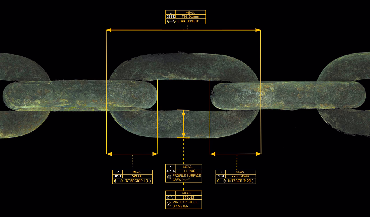
Subsea photogrammetry reconstructs a true-scale 3D model by analysing hundreds of overlapping still images taken from multiple viewpoints. By identifying common reference points or ‘features’ across images, software calculates spatial geometry with high precision, using the age-old reliability of basic trigonometry.
When executed correctly, this method can resolve:
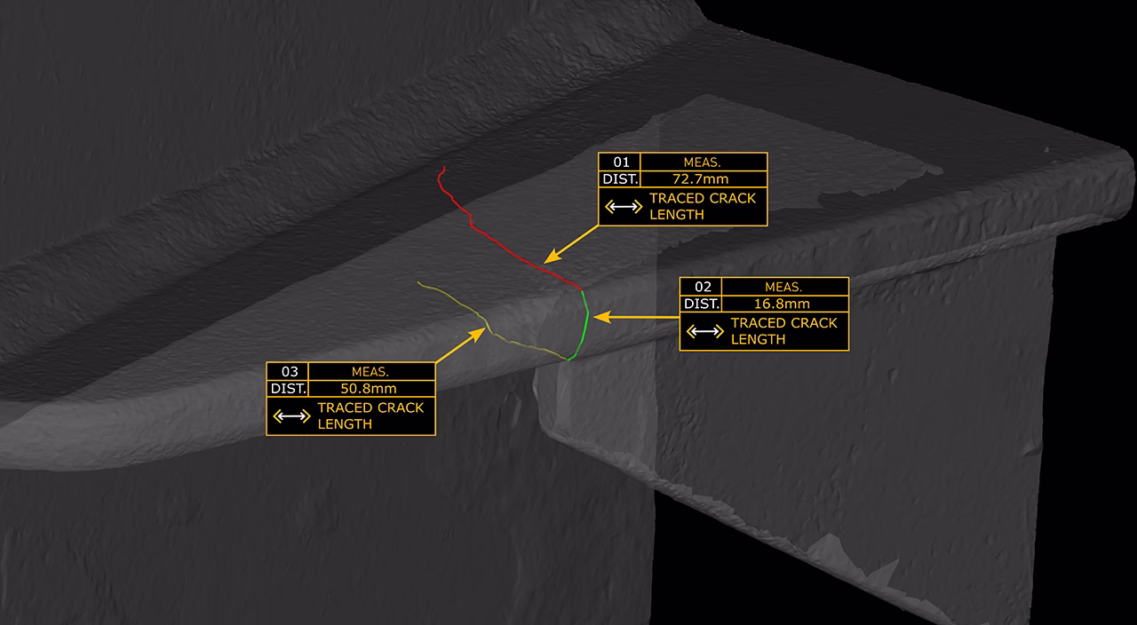
- Hairline cracks and weld defects
- Structural deformation
- Interface geometry for retrofit and fabrication
- Complex and confined environments
Unlike laser or sonar-based systems, photogrammetry excels at capturing fine surface detail and irregular geometry—provided the capture methodology is robust.
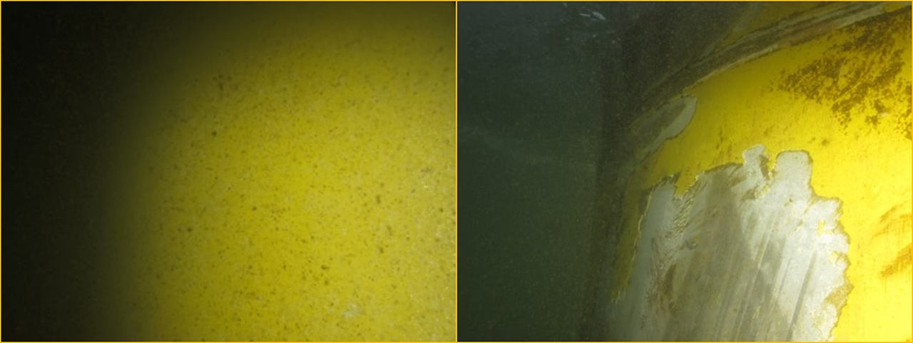
Why does subsea 3D imaging quality vary so widely?
Not all 3D imaging outputs are created equally.
Many offshore systems marketed as “photogrammetry” rely on:
- Low-resolution sensors
- Extracted ‘rolling shutter’ video frames in place of high-resolution still imagery via a global shutter
- Small base-line stereo camera geometry
- Capture system design choices that inherently prevent work in poor visibility or confined spaces
- Visually appealing ‘meshed’ outputs which reduce technical value
- Constant lighting strategies that restrict capture flexibility
The result is often a 3D model which contains inaccurate data – the negative effects of this can be multiplied if the inaccuracies are unknown to the end-user and the data is treated as being technically reliable while real engineering decisions are being made and financial risk remains prominent.
Once the vessel has demobilised, the ability to check or improve the 3D data is gone.
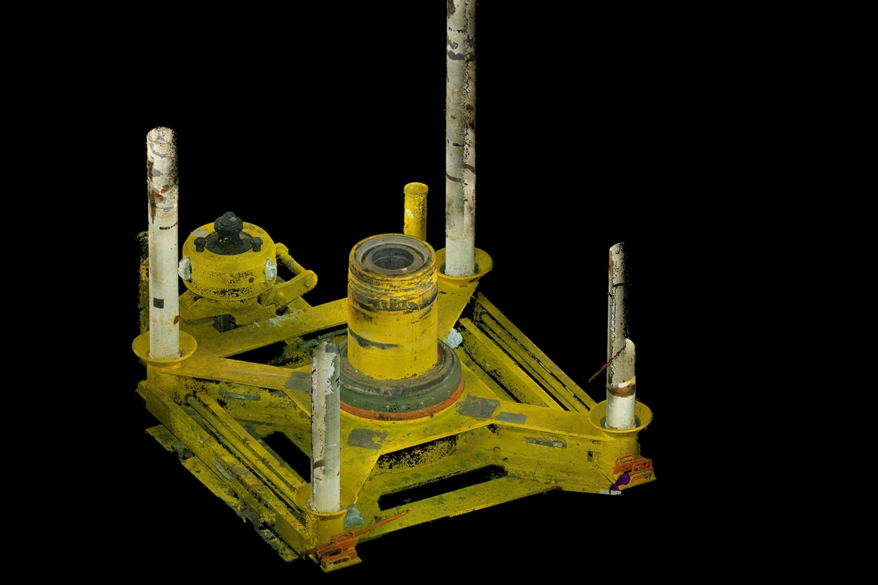
What defines Engineering-Grade Subsea Photogrammetry?
Engineering-grade outcomes are driven by methodology, not marketing.
Key characteristics include:
Competently configured & manually controlled still imagery
Still images contain far more usable spatial data than compressed video, allowing cracks, weld profiles, and deformation to be resolved with far greater reliability and offer a level of value and certainty that video capture simply is not capable of achieving.
Video must use constant lighting which is much less bright than a strobe, meaning that so many camera configuration options (including the most important ones!) are entirely negated.
Additionally, the file size of the still image data will be dwarfed by the lower value video output. In general, we’ve seen that the file size of the video input will take up around 8 times more disk space than digital still images, whilst offering significantly lower value – the worst of both worlds!
In-scene scale references
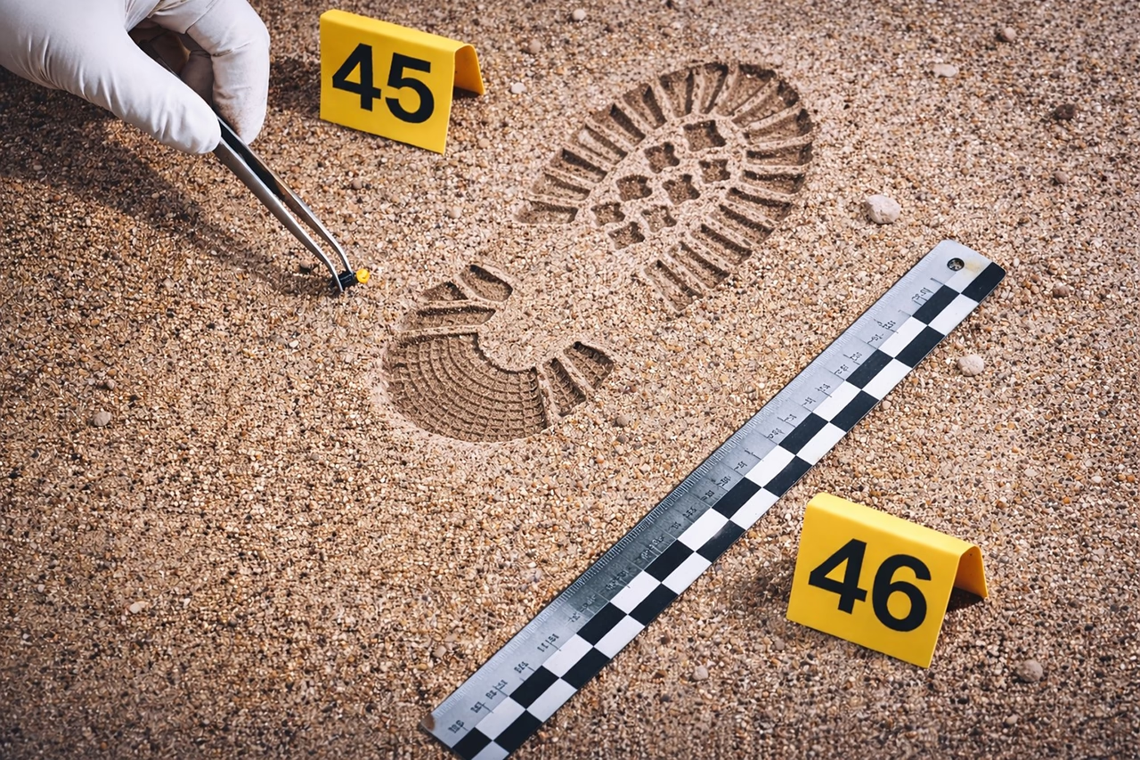
We believe that accuracy should be provable inside the dataset itself. Physical scale references placed in-scene allow measurements to be validated many years later—not just at the time of capture.
As such, future users of the data will not waste time searching for proof of accuracy, rather they can get straight to work. The criminal investigation sector has long understood this need for irreproachable traceability.
Designed for real subsea conditions
Confined spaces, poor visibility, diver-led work, and obstructed access should be considered as normal offshore conditions. Engineering-grade data collected methods are built around this reality, rather than simply being optimised for ideal conditions.
Expert interpretation
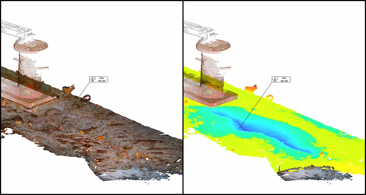
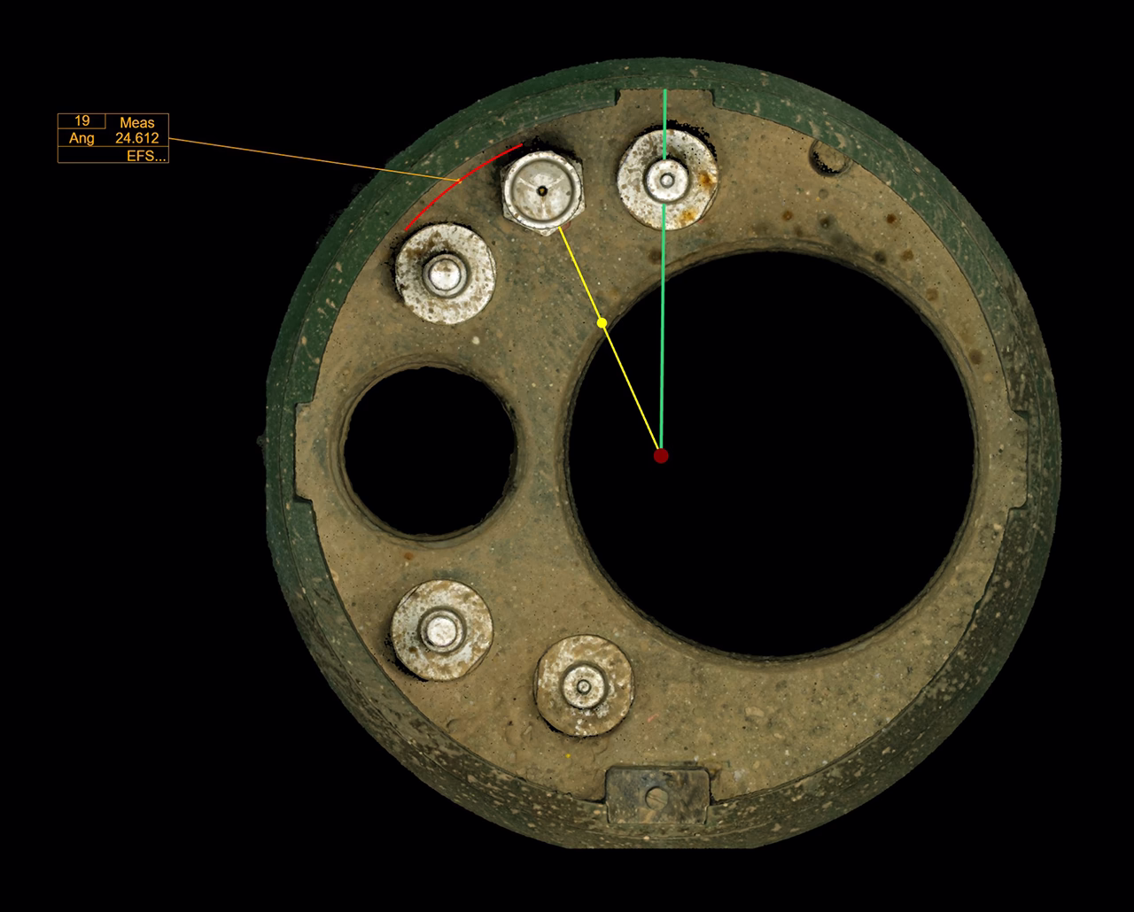
A point cloud alone is not an answer – if your question relates to a dimension, then the answer you’re waiting for is a number. Subsea engineering competence and inspection authority are required to translate 3D data into reliable engineering decisions. In many cases, changing the way the 3D data is viewed to ‘monochrome’, or using deviation analysis as per the below example, can reveal insights that can otherwise remain hidden from view, allowing operational risks to persist.
Where subsea photogrammetry delivers the most value
Subsea 3D imaging creates disproportionate value when uncertainty is expensive. Our subsea inspection and condition assessment service delivers this value across the North Sea and beyond.
Typical high-value use cases include:
- Retrofit design baselines and fit-up verification (Viewport3 have completed dozens of retro-fit projects which concluded with a ‘first-time-fit’ installation campaign).
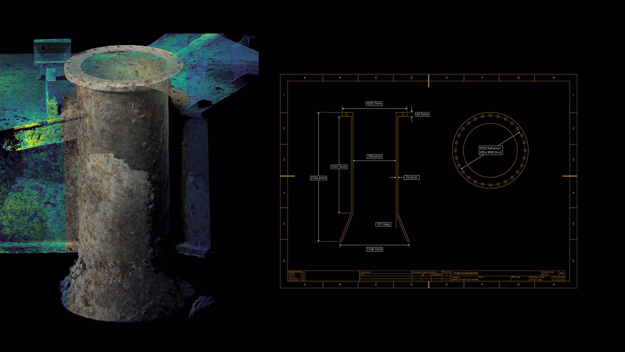
- CAD-ready 3D data for direct import during design — see our point cloud to CAD reverse engineering services
- Virtual dimensional clash detection
- Crack propagation or defect monitoring
- Emergency response when vessels are already offshore
- Confined or internal structures inaccessible to lasers or sonar
In these scenarios, accuracy and provability matter more than speed. The efficiency gained from poorly collected data is quickly negated when expensive rework is required.
From “3D scanning” to dimensional assurance
The most important shift is conceptual.
It is a dimensional assurance methodology — delivering accurate, verifiable, decision-ready data that removes doubt before fabrication or mobilisation begins.
When combined with:
- Proven capture methodology
- Verifiable accuracy
- Subsea engineering and 3.4u inspection expertise
- Inspection-grade reporting
…it removes ambiguity and allows prudent engineering decisions
The future of subsea 3D imaging
Industry pressures are converging:
- Ageing infrastructure
- Reduced tolerance for uncertainty
- Increased regulatory scrutiny
- Greater reliance on digital twins and remote inspection
As these pressures grow, the gap between generic “3D scanning” and engineering-grade photogrammetry will widen.
Retrofit design provides the clearest proof. There is nowhere to hide: either the dataset is accurate and the component fits first time, or it does not — and costly vessel-based rework follows.
Viewport3 has supported engineering teams in achieving first-time-fit outcomes on 30 projects to date — and counting.
The value lies not in producing a model—but in delivering data that stands up when it matters.
Summary
Subsea photogrammetry is not new.
Engineering-grade subsea photogrammetry is rare.
The difference is not technology.
It is discipline, provability, and engineering intent.